At Save the Elephants’ (STE) research camp in northern Kenya, scientists are gaining insight into the lives of wild elephants by tracking them day and night using novel real-time technology. STE WildTracks (formerly known as the STE Tracking App), was built on decades of tracking wild African elephants, and is changing the way researchers and conservationists protect these charismatic animals.
Drawing data from EarthRanger, a real-time software solution, STE WildTracks allows users to visualise where elephants, rhinos or any other animal tracked through the system move. The movements are displayed to highlight not just where the animals go, but also the speed at which they are moving, and where they travel by day and night. By displaying animals in individual colours, the app encourages investigation into what is driving the individual decisions of each elephant
Initially developed for elephants, the app has proved useful for locating any species being tracked. As a compact portable device, STE WildTracks can be used to track wildlife in the field, from the air, by car and on foot. With sophisticated data caching and refreshing, data can either be downloaded at HQ and accessed during the search, or refreshed in the field if a connection is available.
The combination of on-the-fly research and management tool and tracking platform has proved popular beyond elephants, and currently six other species visualise their data using the app. By rebranding as STE WildTracks, and releasing it with several new features, Save the Elephants aims to encourage wider use of its features with other species.

STE’s President and Founder, Dr. Iain Douglas-Hamilton pioneered the use of radio collars on elephants in 1969.
Save the Elephants has been tracking elephants for more than 25 years and remains fully engaged in this field. STE’s founder Dr. Iain Douglas-Hamilton first pioneered the use of radio collars on elephants in 1969, and is widely credited with developing metrics and methods that stemmed the tide of elephant poaching for ivory in Africa. Today, STE facilitates the tracking of over 450 elephants across the continent flowing through its tracking systems.
STE WildTracks, a dedicated app for investigating animal behaviour for research and wildlife management purposes, is used by 33 partners across Africa to track seven other endangered wildlife species, including lions and Grevy’s zebra in Kenya and Scimitar-horned oryx in Chad. It is also used in Myanmar to track Asian elephants. Each animal is fitted with a tracking collar that contains a GPS coordinate. The app pinpoints the location of the animal and assigns each individual a different coloured track, highlighting that individual’s choices in the landscape. The app is optimised for use in the field and from the air, allowing users to find these particular animals and investigate their recent behaviour on the fly.
Born from a collaboration between Save the Elephants and Vulcan Inc., STE started working with the company in 2015 to improve its tracking systems. This led to the creation of EarthRanger – a sophisticated tech platform to monitor protected wildlife areas by drawing in real-time data from cameras, animal collars, radios, aircrafts and vehicle sensors. EarthRanger, now a product of the Allen Institute for Artificial Intelligence, has been adopted in more than 180 protected areas across nearly 50 countries around the world to help not only elephants but all wildlife and the local communities that benefit from them.
Save the Elephant’s head of field operations uses STE WildTracks in the field. Photo courtesy Sean Dundas/Save the Elephants.
Over the years, STE has followed some extraordinary elephant journeys through the tracking app. In particular, lone bull elephants trekking for miles over open and dangerous landscape, either following the paths of their ancestors or even forging new routes. There was Morgan who marched to Somalia and back in 2016; the famous Kenyan elder, Matt, who roamed the longest distance of any elephant in Kenya; and the legendary Mountain Bull from the slopes of Mt Kenya.
The app has helped STE identify and protect important wildlife passageways in Kenya, react swiftly to elephants in trouble from poaching or human-elephant conflict, and gain a bird’s eye view of how humans are impacting elephant movements. Who can forget Tim, the iconic tomato-loving tusker from Amboseli, whose tracking data provided intimate insight into his crop-raiding behaviour and enabled conservation partners to improve rangers patrol strategies so that villagers can live more harmoniously with elephants.
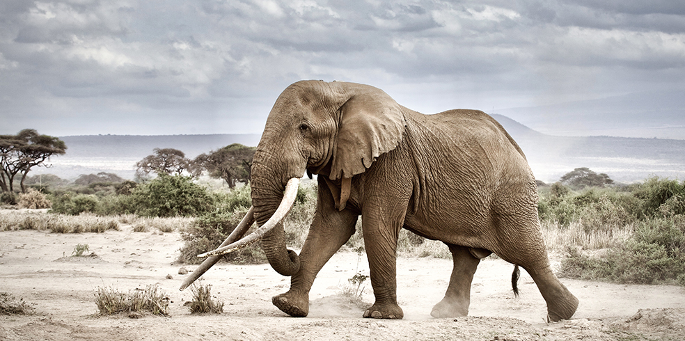
Iconic Tusker, Tim, in Amboseli © Ryan Wilkie/Save the Elephants
STE WildTracks is available to anyone who uses EarthRanger in their protected area and can be downloaded from the App store. It is optimised for use in the field, requires low bandwidth, and has a multitude of functionalities including different satellite and topographical views and the ability to track single or multiple animals, with a 16 day backdated timeline of movement.
CEO of Northern Rangelands Trust, Ian Craig, describes the tracking app as a game-changer. “Not a day goes by that I don’t use the tracking app to check on individual elephants that we monitor across the remote north of Kenya. The app gives elephants a voice: the data helps us work with communities to ensure elephants have room to manoeuvre while the communities can still make a living from the land.”
Save the Elephants is continuously refining the tracking app, and providing new updates. We welcome any feedback from the EarthRanger community.
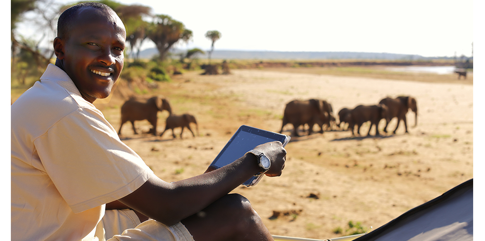
A Save the Elephants researcher uses STE WildTracks. Photo courtesy Save the Elephants.
Top image: Nelson and Benjamin from Save the Elephants use EarthRanger. Photo courtesy Jane Wynyard/Save the Elephants.